You Are Here ![]() Home
Home ![]() Sonar Location
Sonar Location ![]() Drain System Mapping
Drain System Mapping


Drain System Mapping
Building an extension? Taken over an old building and planning to update, add or change the existing drainage system? Building a new house on a plot of land and don't know where the original drainage system is?
The Drain Mapping Survey
An existing drainage system is methodically charted using sonar detection equipment, accessing the system from existing manholes, rodding points and inspection chambers.
This information can then be collated and used to draw up an accurate plan of the drainage system, detailing the location of all main lines, branch lines, hidden access points, hidden connections, manholes, etc.
Additional information on a plan may include locations of all rainwater, foul water and combined water gullies, including rainwater pipes, soil vent pipes and surface water drains, etc.
 Depths are also input into the plan, usually at access points such as manholes or inspection chambers and where necessary, rodding points.
Combined Camera Surveillance and Sonar Mapping
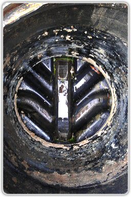
Should it be necessary to also detail the condition of a drainage system, the sonar mapping survey can also be carried out in conjunction with a camera survey.
What’s typically included in the Report?
Below you’ll find some of the details you can expect from a Mapping Survey; of course, situations vary, so do please discuss requirements with your Operative.
DVD survey footage of underground drainage network.
Plan detailing location of underground system.
Measurements and distances.
Pipe depths, diameters and composition.
Manhole and Inspection Chamber locations.
Main and branch line locations.
Hidden access points and connections.
Surface piping and gulley locations.
Details of drain and access point conditions.
Where requested, recommendations and quotes would be covered within the drainage survey report. See Sonar Location and Camera Surveys for more information.